
Satellites used for glodal positioning circle the globe.
As little children we are taught the story of Hansel and Gretel who are faced with the challenge of finding their way home in an unfamiliar woods. As we all remember they discovered that pebbles as signs along the way create a map to follow. This lesson went to our hearts and the automobile clubs led the charge to install street and route signs at every fork in the road. Navigation using signs is a workable method as long as it is daytime and the weather cooperates. I can remember my mother turning on the porch light as a beacon to guide out of town visitors to our house.

Safe travel has long been based on line of sight
position references
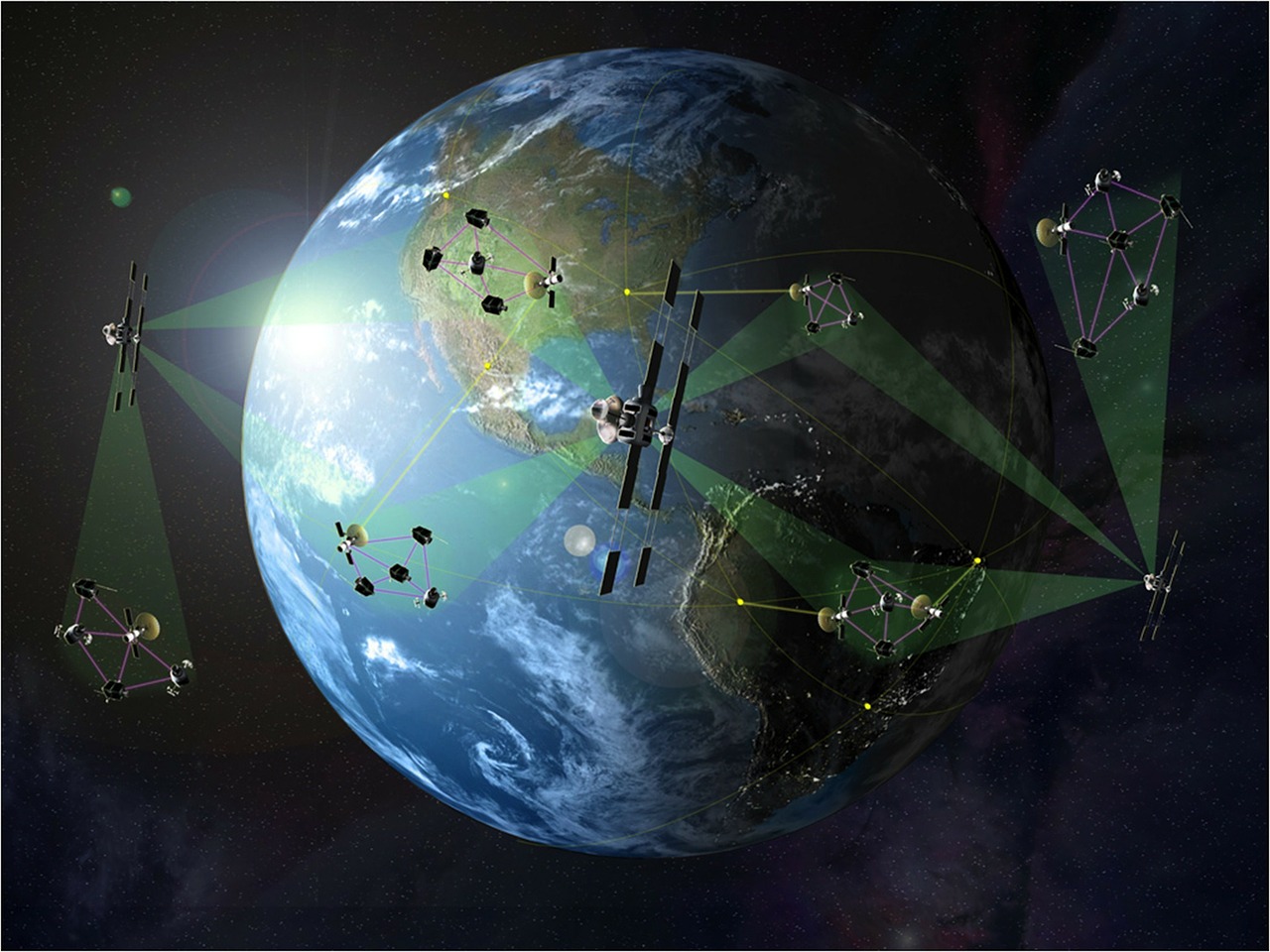
Lighthouses have long been used as beacons to guide sailors safely back to port. During the second world war a concerted effort was made to improve on visual position references. The British development of radar branched into the creation of LORAN.(short for LOng RANge navigation) It was not until the introduction of solid state electronics in the 1970s that marine and military use of LORAN became common. This system used a grid of land radio beacons to calculate the position of ships and planes. Most of the positioning systems still in use today are an evolution of the original LORAN. The position of a GPS receiver is calculated by timing the transmission from 3 or more transmitters in known locations. The measured position accuracy improves if the transmitters are closer or there is fewer obstructions. This is why we primarily use satellite or cell phone based GPS today.
I would like to report that our GPS navigation systems are infallible in their calculation of location. Even though they work most of the time, certain types of obstructions such as parking garages and metal buildings block or reflect the signals. Applications that require continuous guidance, such as the autonomous vehicles that I helped design for warehouse delivery, have additional local beacons to provide sufficiently accurate location. This also overcomes the intentional dithering that the US military adds to the satellite GPS signals. Other useful devices that use GPS locations, such as my www.mileagetrakker.com ,have an embedded workaround that makes the temporary loss of location user invisible. Even though this level of coding is complicated, the user experience is greatly enhanced.
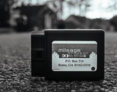
Capture your full mileage deduction
Many of the things that we are trying to achieve are related to our current location. It is not surprising that some of the most successful automation effectively utilizes embedded GPS calculations.